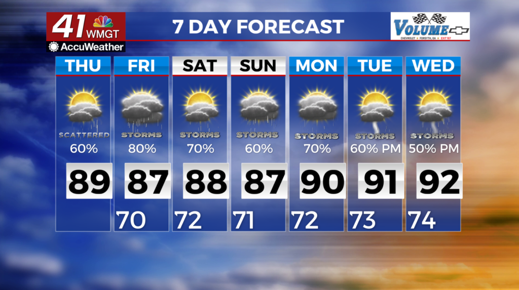
Unsettled pattern continues through the weekend
MACON, Georgia (41NBC/WMGT) – A weak boundary is situated roughly along the I-20 corridor. South of this boundary dewpoints are in the 70s. Showers and storms will likely develop along


and south of this boundary, keeping convection very isolated. Any storms that do form could produce gusty winds (up to around 40 mph). Clusters of showers and storms pushing inland from the Gulf over the Florida panhandle and southeastern Alabama may continue northward through the evening and impact portions of Middle Georgia. The same goes for a sea breeze front moving inland over coastal Georgia from the Atlantic. Patchy fog could develop again with some isolated locales experiencing dense fog, especially where rainfall occurs. Mid to upper level flow becomes southwesterly today with an approaching trough, increasing moisture advection from the tropics (with the help of flow around the Bermuda High setting up). Expect typical summer-time thunderstorms with gusty to localized damaging wind gusts, frequent lightning and heavy rainfall.


