Summer arrives early as temperatures soar into the 90s
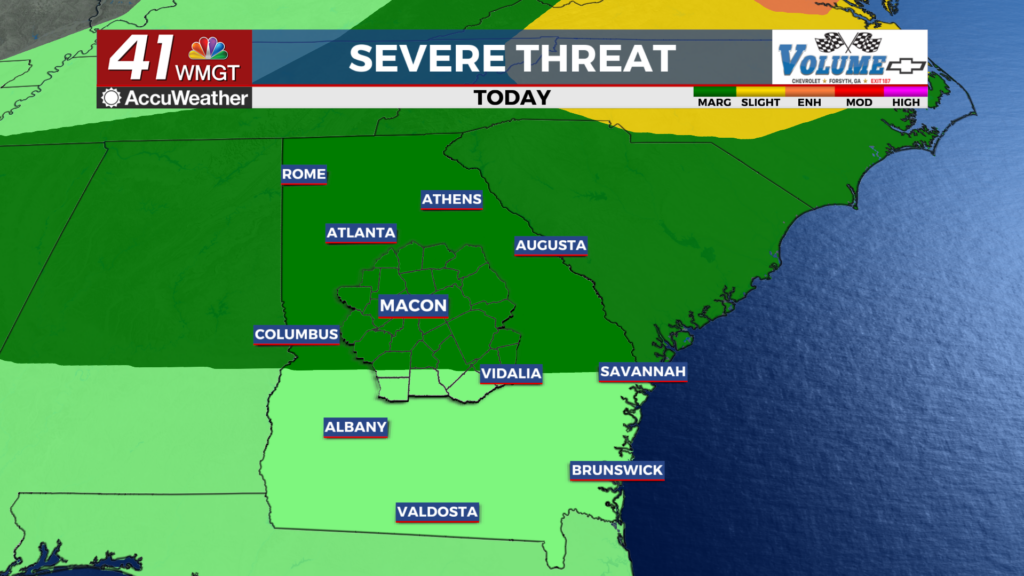
MACON, Georgia (41NBC/WMGT) – Today begins the transition where we finally start to push out this pattern that we’ve been stuck in this past week. The high pressure ridge pushes east into


Mississippi/Alabama through Thursday. This will allow for a frontal boundary to push into Northwest Georgia early Thursday morning and settle in somewhere across Middle/South Georgia Thursday night into Friday. Currently the Storm Prediction Center has outlined most of north and Middle Georgia in a marginal risk and that area may get upgraded to slight risk. The models are still showing the better instability and energy moving across the Carolinas and Mid-Atlantic states for Thursday which is where the slight risk area is currently. This boundary will serve as the main driving force for convection this afternoon/evening. Isolated damaging winds, periods of heavy rain, frequent lightning and maybe some hail will be the biggest threats with some of these storms.


