Severe weather gone, nice weekend on tap
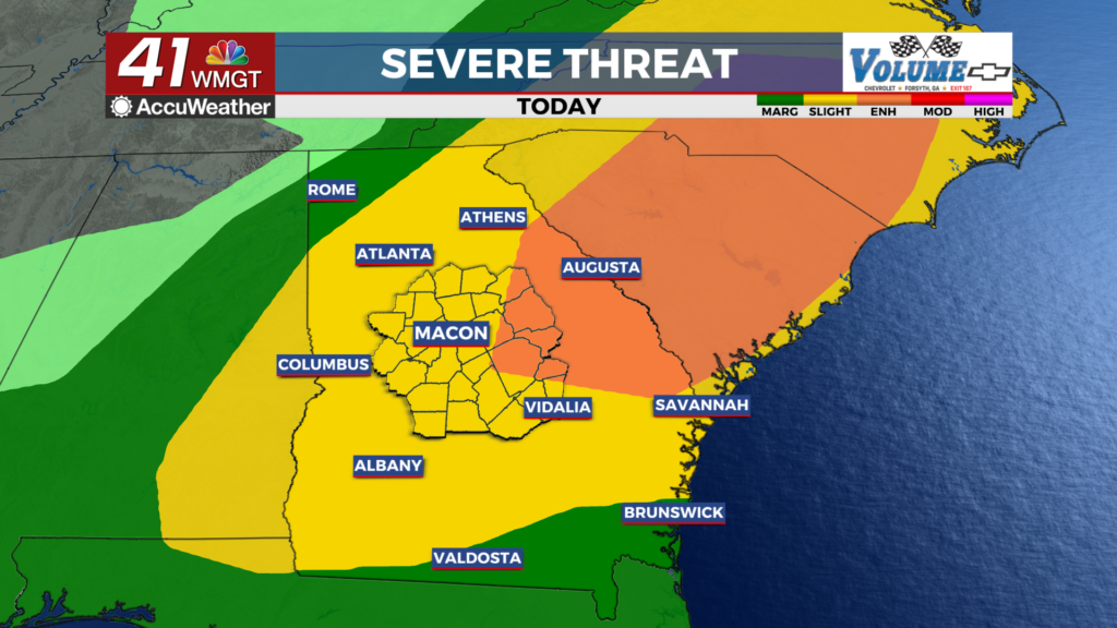
MACON, Georgia (41NBC/WMGT) – A cold front and trough has charged through the state this afternoon. Southwest winds ahead of the front will increase moisture and allow dewpoints to climb


into the upper 60s and low 70s ahead of the front. This rise in moisture combined with daytime heating will increase instability throughout the day. This setup will be sufficient for rotating updrafts and it should favor linear storms with damaging winds (gusts of 40 to 60 mph) as the primary concern. Also, a couple of brief tornadoes are possible. The most favorable area for tornadic development appears to be between I-85 and I-16, where the best combination of instability may exist. The main line of storms should impact the Atlanta metro in the afternoon. Storms should advance south rapidly during the afternoon, clearing Middle Georgia by 5 or 6 pm. A building ridge in the Plains and trough over the northeast will bring northwest flow across Georgia on Saturday. Afternoon high temperatures should peak in the upper 70s to low 80s for most.


