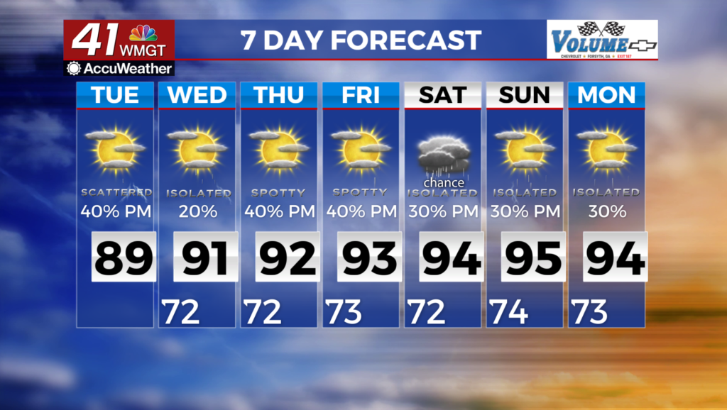
Rising temperatures & heat indices equals very humid days ahead
MACON, Georgia (41NBC/WMGT) – Another day, another round of afternoon and evening showers and thunderstorms, although coverage may be more scattered than in recent days, especially


across North Georgia. The primary driver of this pattern has been a large ridge of high pressure off the coast of the Southeast U.S. The other factor is an upper level shortwave trough moving across the Lower Mississippi Valley. Deep south/southwest flow continues to pump warm humid air across Georgia. There will be plenty of moisture and instability to support isolated to pop-up showers and storms through the evening hours. The primary threats being gusty winds, frequent lightning, and heavy rainfall. After days of heavy rainfall, some areas have saturated soil, so if these areas are hit with additional rounds of showers or storms, we could see localized flooding. For today, the shortwave trough continues to push east across the Tennessee Valley, but gradually weaken. With the environment remaining relatively unchanged, the forcing from the shortwave will bring better shower and thunderstorm chances, especially across Northwest Georgia. Temperatures will be warm and humid each day, with highs reaching the upper 80s across North Georgia, and low 90s across Middle Georgia. Dewpoints in the low-mid 70s will make things feel about 5 degrees higher than that. Lows will only fall to the low 70s.


