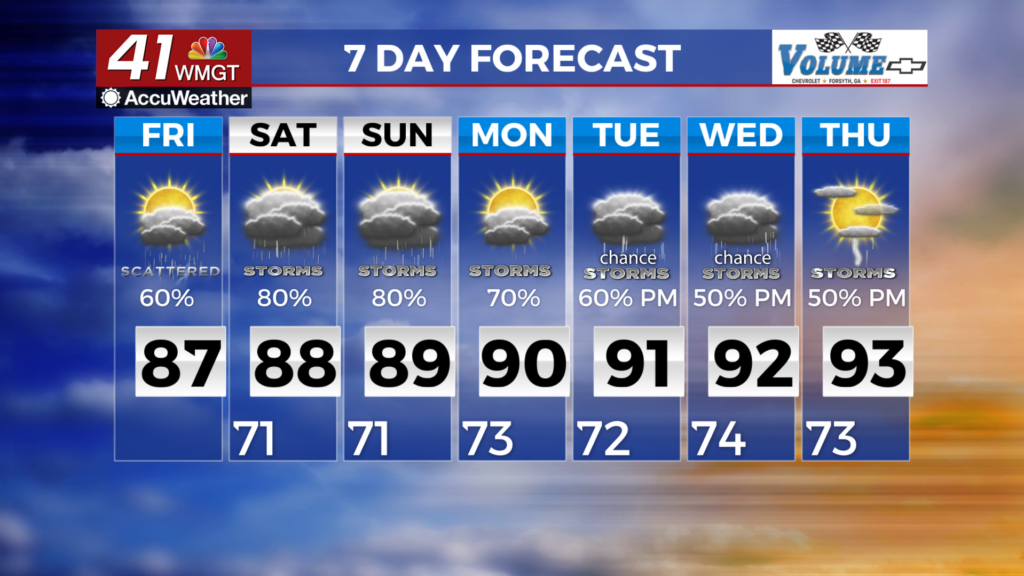
More pop-up storms for the weekend
MACON, Georgia (41NBC/WMGT) – The stalled cutoff low over the western Gulf near the Texas/Louisiana coast will continue to impact the southeast. Combined with moisture, warm June


temperatures, and lift this means thunderstorm chances are likely nearly everyday, peaking in the afternoon each day. Storms will likely be scattered in nature, however, most people will see at least a sprinkle. The main hazards will be frequent lightning and locally heavy rainfall. Beginning Saturday, a trough will extend from the Midwest towards the Lower Mississippi River Valley. This will keep Georgia underneath southwesterly flow as it slowly advances east. Continued flow of warm, moist air from the Gulf will keep dewpoints in the low to mid 70s. Chances for showers and thunderstorms will be higher than normal each day given this ample moisture. Convective activity will be largely diurnally driven, with low possibilities much of the mornings, increasing by the early afternoon and peaking by late afternoon hours each day. A few storms each day could become strong and capable of producing frequent lightning and gusty winds. Patchy fog is possible during the overnight and early morning hours, specifically where soils are saturated from previous rainfall and cloud cover dissipates. Highs will run near normal, in the 80s across the area.


