Isolated storms possible Friday
MACON, Georgia (41NBC/WMGT) – Thunderstorm odds will increase leading up to the weekend.
This Evening


A mostly cloudy afternoon should see things clear up a good bit through the evening and into tonight. It will still be a muggy one despite rain chances being rather low overnight. One or two showers will be possible early. Lows will be in the upper 60s and lower 70s accompanied by light and variable winds. Fog will be possible leading into Friday morning, however overhead skies should be largely clear by tomorrow’s sunrise.
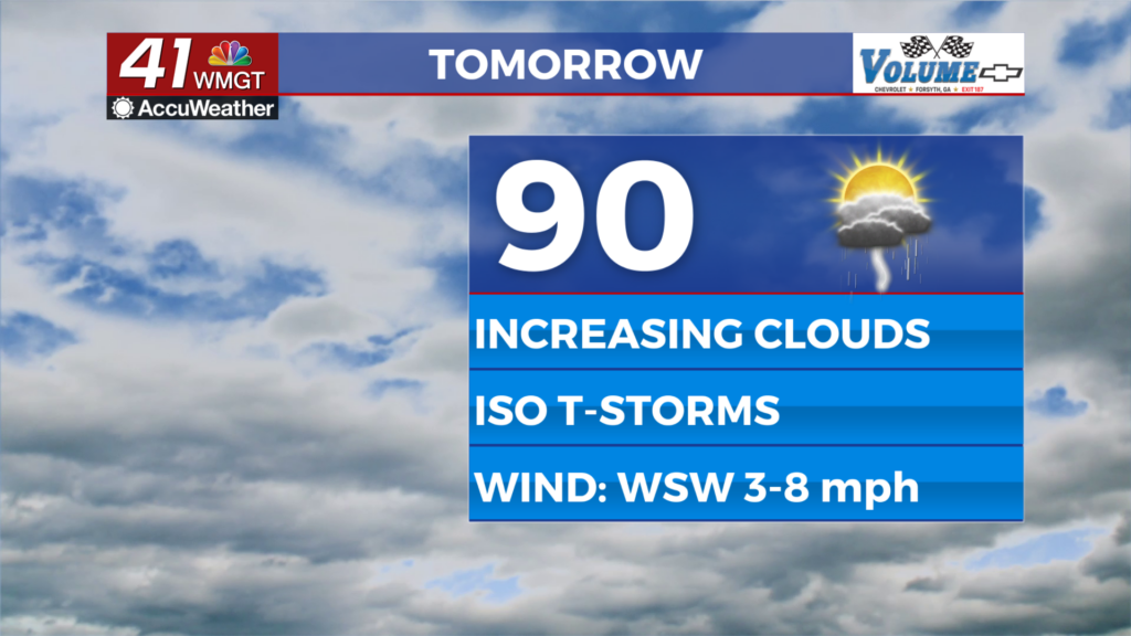
Tomorrow


Friday will feature the best chance for thunderstorms this work week as a new frontal system approaches from the west. That does not mean it will have the most widespread rain, however. That was Wednesday. Expect it to be a hot day to finish the week as there will be plenty of sun early before clouds fill in during the mid to late afternoon. Highs will reach the upper 80s and lower 90s with wind flowing from the west-southwest at 5-10 mph.


As for the storms, those will begin during the mid to late afternoon, becoming most widespread during the evening hours. Most of Middle Georgia is currently included in a Level 1 “Marginal” risk for severe storms. If storms cluster up they could bring a few damaging wind gusts.


Overnight storms will taper off as skies remain partly cloudy. Wind will flow from the southwest at around 5 mph. Fog will be possible again ahead of Saturday morning.
This Weekend and Beyond


The incoming front will stall out over the Peach State yet again this weekend. This means that isolated to scattered storms will be possible both days this weekend as well as into next week. Unfortunately all of Middle Georgia is currently under a Level 2 “Slight” risk for severe weather as strong winds could be more widespread. Sunday also has the eastern counties already highlighted for a potential Level 2 “Slight” risk as well.
Near average temperatures, partly cloudy skies, and isolated to scattered storms will carry into much of next week, so Middle Georgians will not be putting up that rain gear anytime soon.

Follow Chief Meteorologist Aaron Lowery on Facebook (Aaron Lowery 41NBC) and Twitter (@ALowWX) for weather updates throughout the day. Also, you can watch his forecasts Monday through Friday on 41NBC News at 4, 5, 5:30, 6, and 11 p.m.


