Storm odds climb again Thursday
MACON, Georgia (41NBC/WMGT) – An incoming cold front will spur on scattered storms Thursday afternoon and evening.
This Evening


A hot afternoon around Middle Georgia will become a warm and muggy evening. A couple of isolated storms remain possible, however the odds are down quite a bit from yesterday. UV Index values will hover around 10 through the late afternoon and early evening. Overnight lows will be in the lower 70s under mostly clear skies. Wind will be light from the southwest.
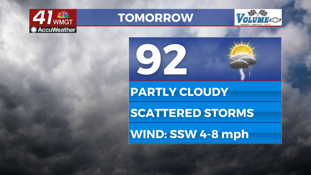
Tomorrow


A bit more cloud cover is likely Thursday with a cold front approaching from the north, however there should be ample sunshine early. Highs will still reach into the low to mid 90s ahead of afternoon storms. Wind will flow from the south-southwest at 5-10 mph.


A Level 1 “Marginal” risk includes most of Middle Georgia for tomorrow. The strongest storms will be capable of bringing wind gusts over 60 mph and some small hail. The tornado odds are extremely slim. Storms will be possible through the late afternoon and into the evening.


One or two storms or a shower may linger into the early parts of the night. The night will feature scattered clouds and muggy conditions with lows and dew points anticipated to be in the lower 70s. Wind will remain light from the west-southwest.
Friday and Beyond


Despite the cold front that will bring storms on Thursday, Friday and the weekend will not be any cooler. Friday is also the official first day of summer and will have the longest amount of daylight hours of the year. It will only get hotter into the weekend with rain chances overall remaining on the back burner.

Follow Chief Meteorologist Aaron Lowery on Facebook (Aaron Lowery 41NBC) and Twitter (@ALowWX) for weather updates throughout the day. Also, you can watch his forecasts Monday through Friday on 41NBC News at 4, 5, 5:30, 6, and 11 p.m.


