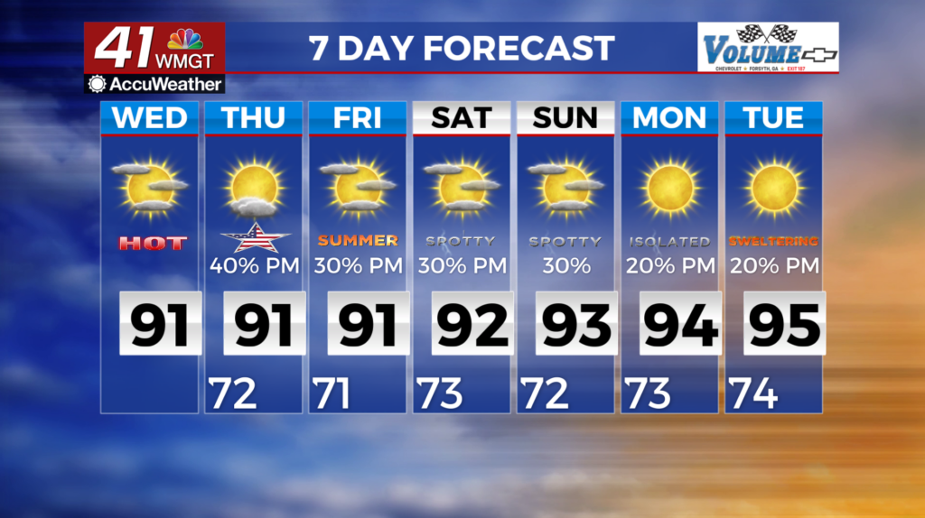
Rain chances lower as temperatures go higher
MACON, Georgia (41NBC/WMGT) – The western edge of the upper level ridge remains over the forecast area, keeping the near stationary shortwave trapped to our west. Southwest flow continues


to pump moisture into the area. Thunderstorm scenario continues with scattered to numerous afternoon and evening thunderstorms. Many in our coverage area are wondering “Will I get thunderstorms today?” and given the pattern the answer remains “maybe.” Chances increase as you move north and west. If you have outside activities this afternoon, be weather aware and remember when thunder roars go indoors. Temperatures through the next few days will be warm and oppressive. Temperatures will be in the 90s for all but the mountains of North Georgia, however, be aware of the time spent outdoors and take frequent breaks. The silver lining is any brief relief thunderstorms may provide, although clear conditions after thunderstorms may make conditions even more oppressive with evaporation from the surface.


