Strong to severe storms possible both days this weekend
MACON, Georgia (41NBC/WMGT) – A slow moving front will bring scattered storms to Middle Georgia both Saturday and Sunday as it moves through the state.
This Evening


The heat was turned up in Middle Georgians today as many spots climbed into the 90s. It will be a muggy night with scattered clouds overhead. A few isolated showers or storms will be possible early. If a storm can mature enough, it could become severe and have a few strong wind gusts. Otherwise, expect it to be calm and muggy with wind from the west-southwest at 5-10 mph accompanied by lows largely in the lower 70s.
Tomorrow


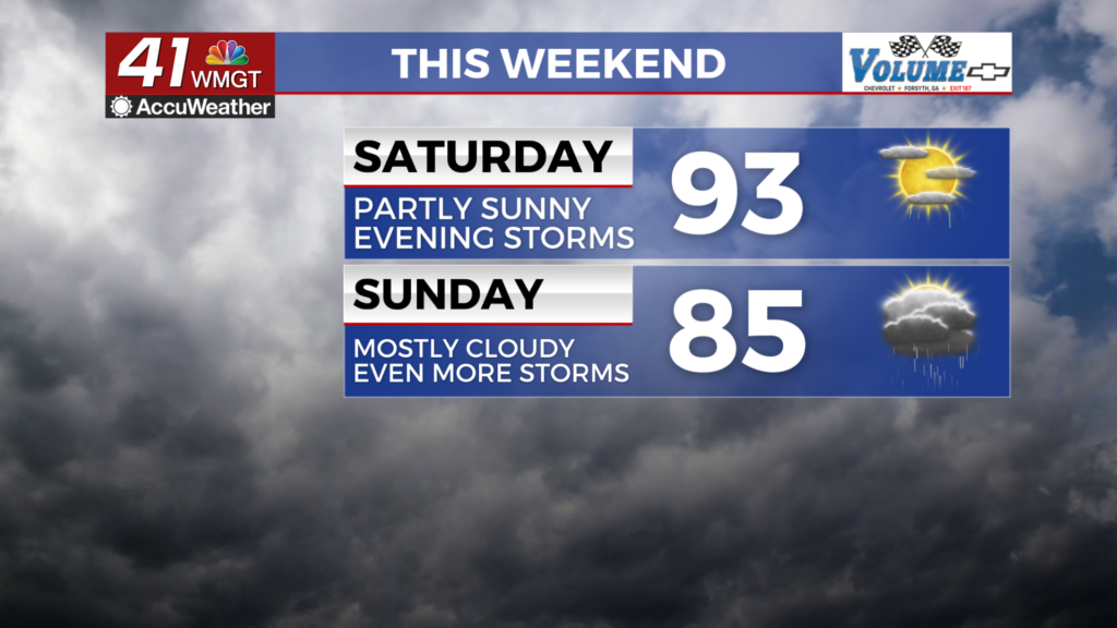
For those who are sick of weekend rain, there is not so great news. There should be a good amount of sunshine through the first half of the day, however showers could begin to pop up during the midday hours. Highs will reach into the low to mid 90s with real feels that could reach into the triple digits. Wind will be breezy from the west-southwest 7-12 mph with gusts that could reach over 20 mph.


These will likely become isolated thunderstorms before more scattered and organized storms move in during the late afternoon and evening. A Level 2 “Slight” risk for severe weather includes the entirety of Middle Georgia with the primary threat being strong winds. Hail or a brief tornado cannot be ruled out, however.


These storms will taper off in the late evening and the overnight should just be mostly cloudy. Lows should be in the low to mid 70s across the region accompanied by gentle wind from the southwest.
Sunday and Beyond


A cloudier and cooler day is likely Sunday in the wake of Saturday evening’s storms. Highs will reach the mid to upper 80s under mostly cloudy skies. Storms will be likely starting in the late morning and going through the afternoon. A Level 2 “Slight” risk includes most of Middle Georgia with the remaining parts included in a Level 1 “Marginal” risk. Overnight shouldn’t see much, however a lingering shower or two early is expected.

The stormy pattern will carry into the new week along with partly to mostly cloudy skies. High temperatures, however, should be a bit below average while overnight lows will continue to remain above normal.

Follow Chief Meteorologist Aaron Lowery on Facebook (Aaron Lowery 41NBC) and Twitter (@ALowWX) for weather updates throughout the day. Also, you can watch his forecasts Monday through Friday on 41NBC News at 4, 5, 5:30, 6, and 11 p.m.


