Strong to severe storms possible for the weekend
MACON, Georgia (41NBC/WMGT) – For the majority of the day and for most of us, Friday will consist of humid, warm, and dry weather. Once we push past 1 pm, a few isolated thunderstorms


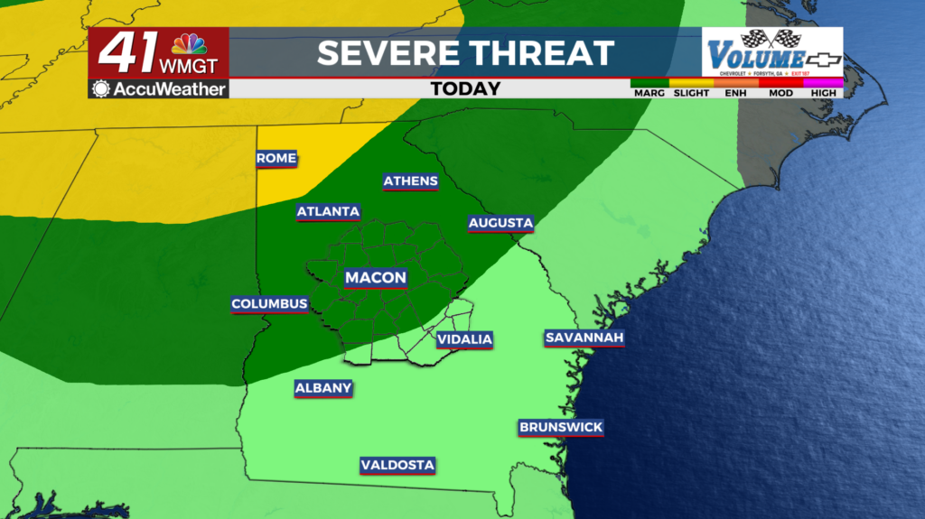
may develop across western or Middle Georgia. We can’t rule out a couple of these storms being on the stronger side with gusts near 40 mph. In general the primary severe weather threat should hold off until Friday evening. This is when a cluster of thunderstorms associated with a weak shortwave traversing Tennessee could move into northwest Georgia. The Storm Prediction Center has maintained the Slight Risk (Level 2 of 5) for severe weather north of I-85. The primary hazard will be damaging winds in the 40 to 60 mph range. The peak period for storm activity and severe risk should occur between 5 pm Friday and 1 am Saturday. Isolated thunderstorm activity may occur south of I-85 overnight. A glance at the extended forecast reveals a literal rinse and repeat pattern, with daytime-driven convection likely each afternoon and evening, further supported by the interaction of a series of shortwaves circling around the base of a trough meandering about the northern Gulf. In addition to the garden-variety, summer-like thunderstorms capable of disrupting any outdoor activities with frequent lightning and locally heavy rainfall, chances for severe thunderstorms will linger through much of the weekend and beyond.


