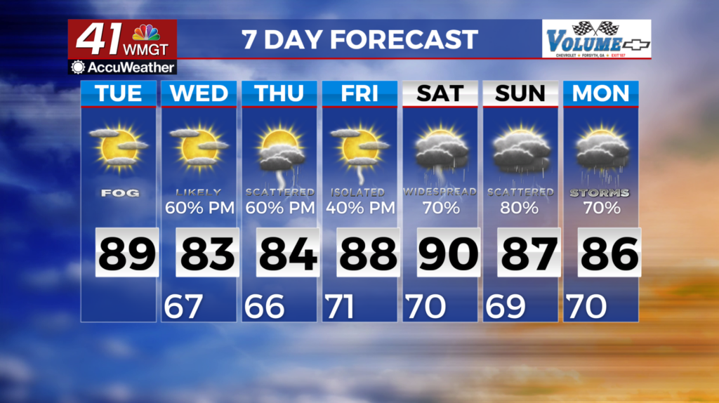
Rain returns for Wednesday
MACON, Georgia (41NBC/WMGT) – A conveyor belt in the upper atmosphere has allowed the jet stream to bring dry hazy air from Canada’s wildfires. Strong high pressure has created a large

ridge which has helped to filter in some haze. As of now, we’re not expecting it to cause any issues other than some dramatic sunrise/sunsets. As the pattern changes and that ridge breaks down over the next 24 hours skies should begin to clear out. Highs will be in the mid to upper 80s with overnight lows comfortably in the low to mid 60s. Relative humidity will gradually rise as winds become more southeasterly; however we’ll be on the dry side for June. For Wednesday through the upcoming weekend expect increasingly unsettled weather conditions. The main weather feature in play will be a northward migrating surface low (from Florida) between Wednesday and Thursday and a cold front that will migrate towards the area from the northwest this weekend. What that means is easterly offshore flow which may result in isolated to widely scattered rain and thunder chances for some of our southern counties between Wednesday and Thursday. Rain and thunder chances will gradually increase as moisture ramps up ahead of the front over the weekend.


