Cold front Friday could bring strong to severe storms to Middle Georgia
MACON, Georgia (41NBC/WMGT) – An incoming cold front will cap off the rainy week with a chance for some severe weather in Middle Georgia.
Today


It will be a cloudy morning with temperatures eventually climbing into the low to mid 80s in the afternoon, accompanied by winds from the west at 7-15 mph. Gusts will likely range 20-25 mph.


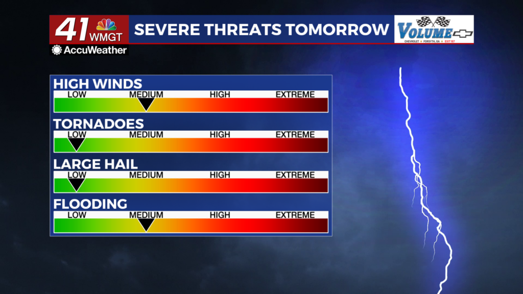
Storms should begin during the middle of the afternoon. A Level 2 “Slight” risk includes all of Middle Georgia for tomorrow afternoon and evening. Primary threats will be strong wind gusts, however a brief tornado or hail cannot be ruled out.


Storms should taper off in the evening and clouds will work to clear out heading into the overnight. Expect a much cooler night heading into the weekend as lows drop into the upper 50s and lower 60s vs the upper 60s and lower 70s that the region has been seeing over the past week. Wind will flow from the northwest at 5-10 mph with the occasional gust pushing 15-20 mph.
This Weekend


Sunshine will be back on Saturday on the backside of the cold front that moved through Friday. It will be a bit breezy with wind from the northwest ranging from 10-15 mph. Sunday should be a bit calmer and may feature a bit more cloud cover. A stray shower cannot be ruled out, however rain odds will be down significantly from the work week.

Follow Chief Meteorologist Aaron Lowery on Facebook (Aaron Lowery 41NBC) and Twitter (@ALowWX) for weather updates throughout the day. Also, you can watch his forecasts Monday through Friday on 41NBC News at 4, 5, 5:30, 6, and 11 p.m.


